 Sale!
Sale! Purple Lizard Map – Laurel Highlands
$14.40 $18.00
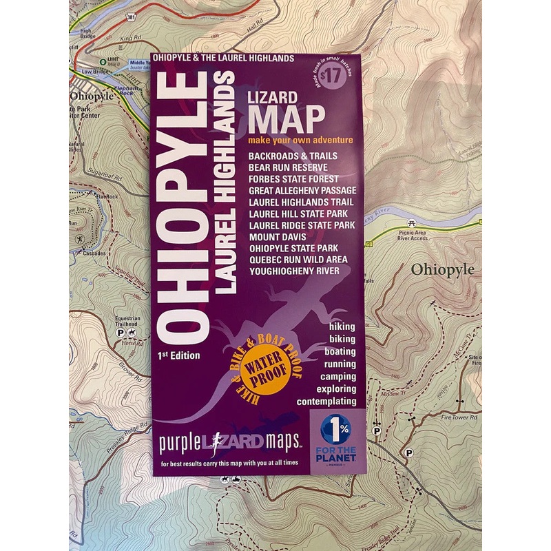
THE OHIOPYLE-LAUREL HIGHLANDS LIZARD MAP WILL HELP YOU PLAN ALL YOUR ADVENTURES IN AND AROUND FORBES STATE FOREST, OHIOPYLE STATE PARK AND THE LAUREL HIGHLANDS REGION.
Super easy to get to:Located within 200 miles of several major metro areas including Pittsburgh, Washington D.C., Baltimore, Cleveland and Columbus,Ohiopyle-Laurel Highlands offers something for every outdoor enthusiast.
Lizard Maps are durable, waterproof, and give you the big picture the map opens to 24 x 36 and folds easily to 4 x 8 to fit in your back pocket. One side features the Laurel Highlands region at a scale of 1:87,000 (1 inch = 1.3 miles) and the other side is a detailed map of Ohiopyle State Park at a scale of 1:27,200 (1 inch = 0.4 mile). Includes both lat./lon. and UTM coordinate systems.
| Cost: | $25 |
| Free Shipping: | We offer free shipping on orders over $30. Please check the free - shipping eligibility at checkout. |
| Delivery Time: | It usually takes [3-5] business days for standard shipping. Please note that this is an estimated time frame and may be affected by local holidays, and unforeseen circumstances. |

Reviews
There are no reviews yet.