 Sale!
Sale! Chrismar Temagami Map
$13.56 $16.95
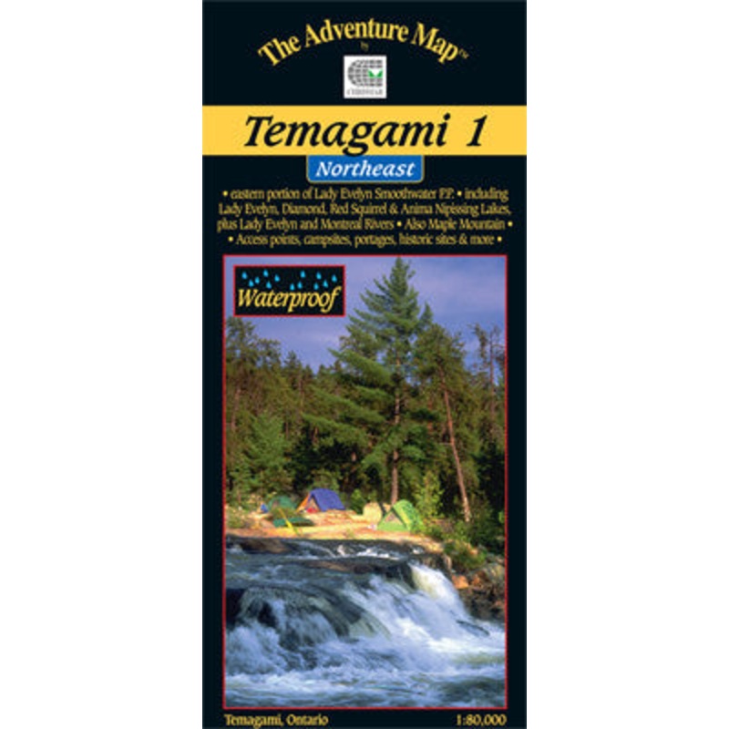
- 1 – Northeast
- 2 – Lake Temagami
- 3 – Martin & Temagami Rivers
- 4 – Northwest & Sturgeon River
- 5 – Chiniguchi Area
- One of the world’s great paddling areas, Temagami provides thousands of lakes and rivers among the rocky forested hills of northern Ontario. This map covers the Northeast quadrant of the main region, and is bounded by Maple Mountain to the west, Latchford and Hwy 11 to the east, Wakimika Lake, Sandy Inlet and Red Squirrel Road to the south and the Spray Creek/Big Spring Lake/Montreal River junction to the north.
In addition to the extraordinary contour, vegetation and water detail on this map Adventure Map has also included most of the formerly official campsites, portages, public hiking trails and access points, as well as historical features, primary fish species by lake, lake elevations, access roads, island numbers and much, much more. Similar in character to the very popular Algonquin series, this map, at 1:80,000 scale, and 24×25″, with a contour interval of 20m, has considerably more detail than government topos or any other map of the area.
As usual the backside of the map is covered with text and lovely colour photos about natural and human history, suggested routes, safety tips, contact information including local outfitters, and much more. Though it covers the area of several government topos and has considerably more detail, this single map is only a third of the cost
- This map shows the heart of Temagami – the octopus-like lake that has become one of Ontario’s most popular tourist destinations. Not only is this a superb paddling and hiking destination, but also a land of a thousand windblown islands, vast forests featuring stands of impressive old-growth red and white pine, fish worthy of great stories, and picturesque water’s edge cottages.
The Lake Temagami map includes the area from Obabika Lake to the west, Diamond Lake to the north, the village of Temagami, White Bear Forest and Cassels Lake to the east, and Wawiashkashi Lake, the edge of the Sturgeon River and Marion Lake to the south.
At 1:80,000 scale this map shows more detail than government topos including campsites, portages, historic features, fish species and the incredibly detailed land and waterscape you’ve come to expect from The Adventure Map. The back side is covered with colour photos and text detailing the natural and human history of the area along with suggested routes, safety tips, contact info and much more. This one has quickly become the standard for on-the-water navigation.
- This map shows the less-well-known southern portion of Temagami, which makes it a great paddling location for those hoping to avoid the summer congestion of Lake Temagami to the north. And it is every bit as worth visiting.
Lots of fine paddling lakes here, and Marten River Provincial Park smack dab in the centre of it all – a great base of operations for your trip. In addition to great campsites and other conveniences, the park has a replica Logging Camp that will take you back to the old days. Most of east half of the map covers the Nipissing Game Preserve where a noticeable abundance of wild animals can be seen – no hunting or trapping is allowed there.
This map includes the area from the west tip of Wicksteed Lake and the railway to the east, Jumping Caribou Lake to the north, Cross Lake and the northern part of Temagami River to the west, and Red Cedar Lake to the south. Also shown is the southern Temagami River – a popular whitewater route – on the back side.
At 1:50,000 scale this map is larger scale than our other Temagami maps and shows considerably more detail than government topos of the same scale. Campsites, portages, access points, lodges are included, plus the incredibly detailed land and waterscape you’ve come to expect from The Adventure Map. The back side is covered with colour photos and text detailing the natural and human history of the area along with suggested routes, safety tips, contact info and much more.
- This map shows the more remote western side of classic Temagami; the ideal area for a fly-in trip or a lengthy multi-week route. In addition to a selection of paddling routes through large and small lakes, there are several great river routes, and even the chance to hike to the highest elevation in Ontario, Ishpatina Peak.
It is a large map showing all or parts of 5 Provincial Parks as well as several Conservation Reserves that border and help protect them. The largest Park is Lady Evelyn-Smoothwater, the eastern portion of which is found on our Temagami 1-Northeast map. LES includes Maple Mountain (another provincial high point) and the afore-mentioned Ishpatina, as well as several large lakes and strings of lakes, plus a whitewater gem, the Lady Evelyn River.
Solace Provincial Park covers an unusual collection of string lakes in probably the most remote part of the area that provides a connection between Florence Lake and the Sturgeon River.
Sturgeon River Provincial Park Is a lengthy, wild river-paddle south through both flat and whitewater sections. The current is slow enough that one can also paddle upstream in parts, making for some interesting route choices. We show it all the way south from Stull Lake area near Ishpatina Peak to the junction with Wawiashkashi Lake.
Obabika River Provincial Park is a meandering river-great for wildlife viewing-that connects the eastern part of Temagami and Obabika Lake to the Sturgeon River.
You’ll also find and inset of Makobe-Grays Provincial Park which follows the Makobe River north from Banks and Makobe lakes to the small Town of Elk Lake on the Montreal River.
Altogether, these Parks and their companion Conservation Reserves provide a grand network of protected wilderness and canoe routes.
At an ideal paddling scale of 1:80,000, this map shows considerably more detail than government topos of larger scale. Campsites, portages, access points, falls, rapids and much more are included, plus the incredibly detailed land and waterscape you’ve come to expect from The Adventure Map. The back side is covered with colour photos and text detailing the natural and human history of the area along with suggested routes, safety tips, contact info and much more.
- This map shows the southwestern side of classic Temagami, an area of relatively easy access by car to a number of points along the southern edge, plenty of remote paddling, connections to other parts of Temagami or the ideal area for a fly-in trip. In addition to a selection of paddling routes through large and small lakes, there are several great river routes, one of the higher peaks in Ontario, and the fabulous Wolf Lake Forest Reserve, renowned for its white quartz cliffs, and even a secret lagoon.
Scale: 1:60,000
| Cost: | $25 |
| Free Shipping: | We offer free shipping on orders over $30. Please check the free - shipping eligibility at checkout. |
| Delivery Time: | It usually takes [3-5] business days for standard shipping. Please note that this is an estimated time frame and may be affected by local holidays, and unforeseen circumstances. |

Reviews
There are no reviews yet.