 Sale!
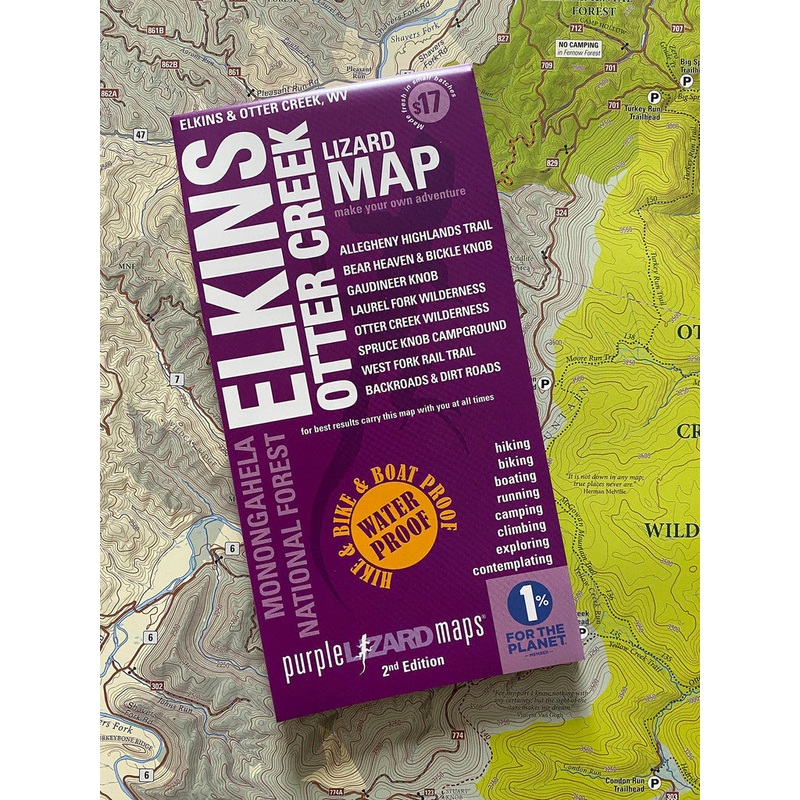
Sale! Purple Lizard Maps – Elkins Otter Creek
$13.60 $17.00
The Elkins-Otter Creek Lizard Map will help you plan all your adventures in and around the northwestern tier of Monongahela National Forest including the Otter Creek and Laurel Fork Wilderness.
A beautifully designed, easy to read topographic map featuring contour lines, elevation data, shaded relief, and all the key details you need to plan your adventures: backroads and trails, trail use designations, road surfaces (paved/gravel/4wd), parking access, campsites, public lands, historic sites and more.
Lizard Maps are durable, waterproof, and give you the big picture the map opens to 24 x 36 and folds easily to 4 x 8 to fit in your back pocket. The scale is 1:48,000 (1 inch = 0.75 mile). Includes both lat./long and UTM coordinate systems.
| Cost: | $25 |
| Free Shipping: | We offer free shipping on orders over $30. Please check the free - shipping eligibility at checkout. |
| Delivery Time: | It usually takes [3-5] business days for standard shipping. Please note that this is an estimated time frame and may be affected by local holidays, and unforeseen circumstances. |

Reviews
There are no reviews yet.