 Sale!
Sale! Purple Lizard Maps – Michaux
$13.60 $17.00
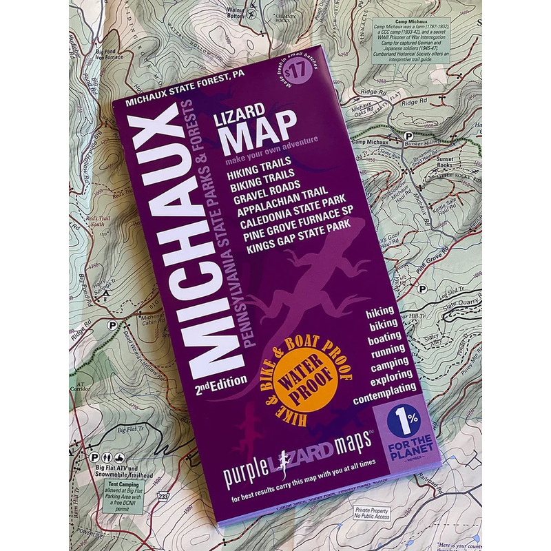
The Michaux Lizard Map will help you plan all your adventures in and around Michaux State Forest, one of the most popular outdoor recreationplaygroundsin Pennsylvania. Michaux’s 85,000 + acres of public land offers something for everyone!
A beautifully designed, easy to read topographic map featuring contour lines, elevation data, shaded relief, and all the key details you need to plan your adventures: backroads and trails, trail use designations, road surfaces (paved/gravel/4wd), parking access, campsites, public lands, historic sites and more.
The 7th map in our lineup of the PennsylvaniaAdventure Series, the Michaux Lizard Map covers the northern region from Shippensburg to Mount Holly Springs and southto Biglerville and Waynesboro PA.
Durable, waterproof, and gives you the big picture the map opens to 24 x 36 and folds easily to 4 x 8 to fit in your back pocket. The scale is 1:37,270 (1.7 inches = 1 mile). Includes both lat./lon. and UTM coordinate systems.
| Cost: | $25 |
| Free Shipping: | We offer free shipping on orders over $30. Please check the free - shipping eligibility at checkout. |
| Delivery Time: | It usually takes [3-5] business days for standard shipping. Please note that this is an estimated time frame and may be affected by local holidays, and unforeseen circumstances. |

Reviews
There are no reviews yet.